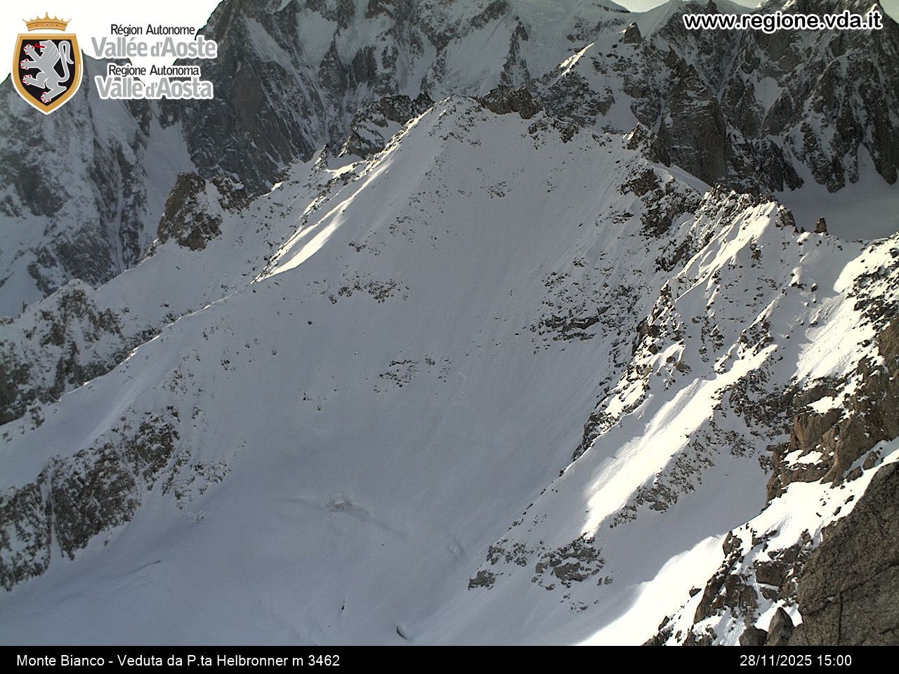
Fondazione Montagna Sicura - Courmayeur
Da sabato l'ingresso di venti moderati o forti da nord ha determinato l'abbassamento delle temperature; questa mattina, in quota, si osserva un leggero aumento a causa dell'arrivo da ovest di aria più mite e umida che determinerà un progressivo peggioramento delle condizioni del tempo. Il manto nevoso si presenta ben rigelato a tutte le quote, con croste da fusione e rigelo fino a 3500 m a sud e 2800 m a nord, più in alto si trova neve a debole coesione che diventa progressivamente rara alzandoci di quota nelle zone maggiormente interessate dal vento; pertanto oltre i 3000 m possiamo trovare neve farinosa oppure croste di neve ventata alternate a zone in cui emerge il fondo duro di neve vecchia.
Fondazione Montagna Sicura - Courmayeur
The cloud cover and the high humidity levels in recent days prevent the surface layer of snow from refreezing and are helping it to progressively melt at least up to a height of 2700-2800m. Even the fresh snowfall of the last 24 hours, above about 1800m, at depths of 25cm in Valdigne and in the area of Gran San Bernardo and a few centimetres elsewhere, is slushy up to 2800-3000m. Mont Blanc, glacier descent of Toula, Attention! falling rocks have been signalled on the Toula. Gran Paradiso (Saturday and Sunday): excellent climbing conditions in the early morning; strictly comply with the times given - the snow quickly begins to yield and the descent is to be made by end of morning on breaking snow. Continuous coverage is above 2600m. There has been climbing both by ski-mountaineers and using crampons on excellent track. At the weekend, also the ski-mountaineering tour of the four mountain huts is busy (Sella, Chabod, Emanuele and Pontese all open). Good snow conditions generally. Matterhorn and Breithorn visited by a number of ski-mountaineers; hard snow so crampons are essential. Granta Parey: as already mentioned in the general conditions, in the last two days there has been little in the way of refreezing at night and the snow is melting.
Fondazione Montagna Sicura - Courmayeur
The good weather at the weekend led to the mountains being very busy. Below is some information coming from the Alpine guides. Mont Blanc, Dôme de Miage: the crossing is icy in the upper part, with a marked out route on good snow for an easy descent all the way to Frasse. Descent on the Trèlatête Glacier: favourable conditions, refrozen spring snow, good descent down the gorge, with the road down to Notre Dame de la Gorge all snow covered. Cervinia: descent of Porta Nera, with access from the Klein Matterhorn marked out, the upper part with windblown snow, the central part very heavily tracked like a mogul piste, and the lower part powdery and very tracked. It is easy to get to the Furri pistes without having to remove skis. Unter Theodulo: upper part with powdery snow, the crevasses are well closed, marked out but still with possibility of new tracks. Easy to ski down all the way to Furri. Castore: marked out with good snow. Descent of the Breithorn hill on the Verra plateaux (Champoluc), marked out in the spring snow.
Fondazione Montagna Sicura - Courmayeur
For the last 5 days the weather has been good with clear skies and mild temperatures. Overnight minimum temps have gone just below zero above 2300-2500 metres, while the daytime maximum has reached average levels of +6°C at 2500m. Above 2800-3000m, the temperatures have stayed below freezing even in the daytime. The process of the snow cover settling is continuing, particularly below 2400m due to the poor refreezing overnight and the high daytime temperatures. During the night, the clear skies and the temperature inversion have resulted in the surface layers of the snow covering refreezing above 1600-1800m. In the morning, the rise in temperatures and sunlight melt the surface layers, making them no longer supportable
Fondazione Montagna Sicura - Courmayeur
La spolverata di neve di martedì mattina non ha generalmente modificato l'innevamento ed è stata più consistente (fino a 15 cm a 2000 m) nelle valli di Champorcher, Cogne e Valsavarenche. In alcune zone a bassa quota, in particolare nelle valli di Ayas e Gressoney, i 5 cm di neve fresca hanno solo ricoperto e nascosto i sassi sottostanti. Alle esposizioni soleggiate, il rialzo delle temperature e il sole hanno velocemente umidificato la nuova neve al di sotto di 2700 m: al mattino lo strato superficiale è crostoso, per poi diventare prima umido, poi pesante e bagnato, col passare delle ore; oggi il manto nevoso è completamente bagnato sotto i 2300 m. A nord sopra i 2200 m troviamo ancora una neve farinosa, bella da sciare.
Fondazione Montagna Sicura - Courmayeur
Over the last two nights the air temperature has stayed above zero up to 2800m (minimum +4°C at 2000m), however the surface of the snow has slightly re-frozen even in the woods. During the day, Aeolian winds have offset the temperature rise both yesterday and today, limiting how much the snow surface exposed to the sun has melted. Skiing conditions are generally good, particularly in the shady areas, although locally some snow is not sticking well to rocks hidden beneath and require some attention. Even the sunniest slopes are not bad, with practically spring-like snow on the surface. Off-piste skiing: descent from the Vallée Blanche dell'Envers is in excellent condition, the crest is equipped with two variants, the glacier is well closed, descent all covered in snow, and it is possible to descend down to Chamonix, but having to take off your skis a couple of times. Descent to Toula: all compact snow with excellent re-freezing conditions. Pay attention to the times. Mountain climbing: the North face of Tour Ronde is busy, narrow passages with ice, a bit of snow at the peak. Still plenty of mountain skiing, Pointe La Pierre, good re-freezing, naturally all very well marked out, descent still on compact snow. Col Serena, excellent re-freezing conditions and descent on spring-like snow, and also here many tracks. The Colle di Malatrà is also still busy (crampons are worthwhile) as is Mont Flassin. In Valgrisenche, the Feluma and Arp Vielle climbs are all in good condition, with compact and transformed snow along practically the whole path. Also the Bettolina Pass in Valle d'Ayas has been climbed, with still some powdery snow above the Verra plateaux.
Fondazione Montagna Sicura - Courmayeur
Ottimo rigelo notturno con temperature minime, a 2000 m, comprese tra -7 e -11°C. e spolverata di neve fresca in paricolar modo sui rilievi di confine. Alle diverse esposizioni, salvo eccezioni sui versanti più in ombra, il manto nevoso si mantiene umidificato negli strati basali al di sotto dei 2500-2600 m, determinando localmente un'instabilità di fondo che può generare spontanei lastroni al terreno sui pendii molto ripidi e maggiormente soleggiati al di sotto dei 2300-2500 m. La neve recente ha subito un rapido assestamento e si presenta ancora a debole coesione alle esposizioni in ombra e con una crosta da fusione e rigelo alle esposizioni soleggiate al disotto dei 2300 m. Ci attende un periodo con condizioni anticicloniche e miti. Le temperature sono previste in graduale rialzo, in particolare da domenica, con zero termico prossimo a 3000 m. Le notti dovrebbero trascorrere serene con un buon irraggiamento e rigelo del manto nevoso almeno oltre il limite del bosco.
Fondazione Montagna Sicura - Courmayeur
La Regione è stata interessata da due flussi perturbati. Il primo verificatosi tra la serata di sabato e la mattinata di domenica, con quota neve a 1600-1800 m, ha interessato maggiormente i settori del Monte Rosa e del Gran Parasiso con punte di neve fresca di 25 cm a 2000 m. La seconda perturbazione incominciata nella notte tra domenica e lunedì e attualmente in fase di esaurimento, caratterizzata da una quota neve variabile dai 1600 ai 2000 m, ha apportato 5-10 cm di neve fresca lungo la dorsale di confine con la Svizzera e 1-5 cm sul resto della Regione. In particolare lungo la dorsale di confine con la Svizzera le due nevicate hanno cumulato a 2500 m di quota anche 30-35 cm di neve fresca. Venti generalmente di moderata intensità e di provenienza nord occidentale hanno interessando durante il passaggio dei flussi perturbati buona parte del territorio regionale. L'intensità dei venti ed il fatto che la neve fresca risulta generalmente asciutta sta facilitando la formazione di nuovi accumuli eolici, principalmente sui pendii meridionali e orientali al di sopra del limite del bosco.
Fondazione Montagna Sicura - Courmayeur
Fondazione Montagna Sicura - Courmayeur
A causa della mite temperatura dell'aria si registra uno scarso rigelo notturno fino a 2000-2400 m di quota; le temperature a 2500-3000 m di quota variavano tra +3 ° e +1 °C, valori superiori di ben 7 °C rispetto alla notte precedente. L'innevamento è ancora abbondante lungo la dorsale alpina. In relazione alle diverse altitudini, a causa dei numerosi episodi di vento forte che hanno caratterizzato quest'inverno, in alta quota l'altezza neve è inferiore alla media, con creste e dossi erosi fino al suolo, neve molto dura, compattata dal vento ed alcuni ghiacciai con ghiaccio affiorante; per contro nella fascia di media montagna il bosco ha mitigato gli effetti del vento e quindi la neve è più abbondante o comunque nella media. In generale la sciabilità è mediocre perché la superficie del manto nevoso cambia repentinamente in poco spazio, con l'alternanza di croste portanti e non portanti da rigelo o da vento.
Da oggi temperature in calo, in particolare domenica quando lo zero termico è previsto intorno a 1700-2000 m di quota, non si prevede alcuna attività valanghiva spontanea.


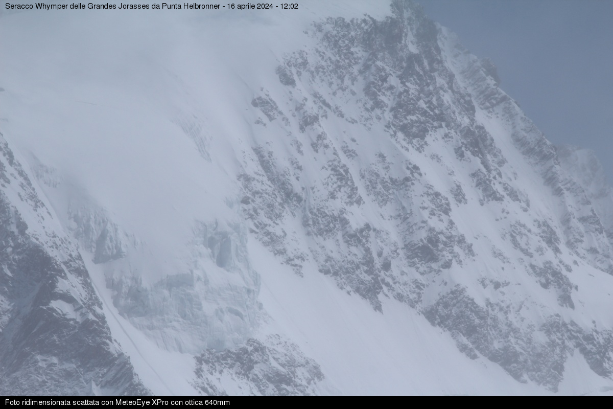
Il manto nevoso si presenta ben rigelato a tutte le quote, con croste da fusione e rigelo fino a 3500 m a sud e 2800 m a nord, più in alto si trova neve a debole coesione che diventa progressivamente rara alzandoci di quota nelle zone maggiormente interessate dal vento; pertanto oltre i 3000 m possiamo trovare neve farinosa oppure croste di neve ventata alternate a zone in cui emerge il fondo duro di neve vecchia.
Even the fresh snowfall of the last 24 hours, above about 1800m, at depths of 25cm in Valdigne and in the area of Gran San Bernardo and a few centimetres elsewhere, is slushy up to 2800-3000m.
Mont Blanc, glacier descent of Toula, Attention! falling rocks have been signalled on the Toula. Gran Paradiso (Saturday and Sunday): excellent climbing conditions in the early morning; strictly comply with the times given - the snow quickly begins to yield and the descent is to be made by end of morning on breaking snow. Continuous coverage is above 2600m. There has been climbing both by ski-mountaineers and using crampons on excellent track. At the weekend, also the ski-mountaineering tour of the four mountain huts is busy (Sella, Chabod, Emanuele and Pontese all open). Good snow conditions generally. Matterhorn and Breithorn visited by a number of ski-mountaineers; hard snow so crampons are essential. Granta Parey: as already mentioned in the general conditions, in the last two days there has been little in the way of refreezing at night and the snow is melting.
Mont Blanc, Dôme de Miage: the crossing is icy in the upper part, with a marked out route on good snow for an easy descent all the way to Frasse. Descent on the Trèlatête Glacier: favourable conditions, refrozen spring snow, good descent down the gorge, with the road down to Notre Dame de la Gorge all snow covered. Cervinia: descent of Porta Nera, with access from the Klein Matterhorn marked out, the upper part with windblown snow, the central part very heavily tracked like a mogul piste, and the lower part powdery and very tracked. It is easy to get to the Furri pistes without having to remove skis. Unter Theodulo: upper part with powdery snow, the crevasses are well closed, marked out but still with possibility of new tracks. Easy to ski down all the way to Furri.
Castore: marked out with good snow. Descent of the Breithorn hill on the Verra plateaux (Champoluc), marked out in the spring snow.
During the night, the clear skies and the temperature inversion have resulted in the surface layers of the snow covering refreezing above 1600-1800m. In the morning, the rise in temperatures and sunlight melt the surface layers, making them no longer supportable
Alle esposizioni soleggiate, il rialzo delle temperature e il sole hanno velocemente umidificato la nuova neve al di sotto di 2700 m: al mattino lo strato superficiale è crostoso, per poi diventare prima umido, poi pesante e bagnato, col passare delle ore; oggi il manto nevoso è completamente bagnato sotto i 2300 m.
A nord sopra i 2200 m troviamo ancora una neve farinosa, bella da sciare.
Over the last two nights the air temperature has stayed above zero up to 2800m (minimum +4°C at 2000m), however the surface of the snow has slightly re-frozen even in the woods.
During the day, Aeolian winds have offset the temperature rise both yesterday and today, limiting how much the snow surface exposed to the sun has melted. Skiing conditions are generally good, particularly in the shady areas, although locally some snow is not sticking well to rocks hidden beneath and require some attention. Even the sunniest slopes are not bad, with practically spring-like snow on the surface.
Off-piste skiing: descent from the Vallée Blanche dell'Envers is in excellent condition, the crest is equipped with two variants, the glacier is well closed, descent all covered in snow, and it is possible to descend down to Chamonix, but having to take off your skis a couple of times. Descent to Toula: all compact snow with excellent re-freezing conditions. Pay attention to the times.
Mountain climbing: the North face of Tour Ronde is busy, narrow passages with ice, a bit of snow at the peak. Still plenty of mountain skiing, Pointe La Pierre, good re-freezing, naturally all very well marked out, descent still on compact snow. Col Serena, excellent re-freezing conditions and descent on spring-like snow, and also here many tracks. The Colle di Malatrà is also still busy (crampons are worthwhile) as is Mont Flassin. In Valgrisenche, the Feluma and Arp Vielle climbs are all in good condition, with compact and transformed snow along practically the whole path. Also the Bettolina Pass in Valle d'Ayas has been climbed, with still some powdery snow above the Verra plateaux.
Alle diverse esposizioni, salvo eccezioni sui versanti più in ombra, il manto nevoso si mantiene umidificato negli strati basali al di sotto dei 2500-2600 m, determinando localmente un'instabilità di fondo che può generare spontanei lastroni al terreno sui pendii molto ripidi e maggiormente soleggiati al di sotto dei 2300-2500 m. La neve recente ha subito un rapido assestamento e si presenta ancora a debole coesione alle esposizioni in ombra e con una crosta da fusione e rigelo alle esposizioni soleggiate al disotto dei 2300 m.
Ci attende un periodo con condizioni anticicloniche e miti. Le temperature sono previste in graduale rialzo, in particolare da domenica, con zero termico prossimo a 3000 m. Le notti dovrebbero trascorrere serene con un buon irraggiamento e rigelo del manto nevoso almeno oltre il limite del bosco.
Venti generalmente di moderata intensità e di provenienza nord occidentale hanno interessando durante il passaggio dei flussi perturbati buona parte del territorio regionale. L'intensità dei venti ed il fatto che la neve fresca risulta generalmente asciutta sta facilitando la formazione di nuovi accumuli eolici, principalmente sui pendii meridionali e orientali al di sopra del limite del bosco.
A causa della mite temperatura dell'aria si registra uno scarso rigelo notturno fino a 2000-2400 m di quota; le temperature a 2500-3000 m di quota variavano tra +3 ° e +1 °C, valori superiori di ben 7 °C rispetto alla notte precedente.
L'innevamento è ancora abbondante lungo la dorsale alpina. In relazione alle diverse altitudini, a causa dei numerosi episodi di vento forte che hanno caratterizzato quest'inverno, in alta quota l'altezza neve è inferiore alla media, con creste e dossi erosi fino al suolo, neve molto dura, compattata dal vento ed alcuni ghiacciai con ghiaccio affiorante; per contro nella fascia di media montagna il bosco ha mitigato gli effetti del vento e quindi la neve è più abbondante o comunque nella media.
In generale la sciabilità è mediocre perché la superficie del manto nevoso cambia repentinamente in poco spazio, con l'alternanza di croste portanti e non portanti da rigelo o da vento.
Da oggi temperature in calo, in particolare domenica quando lo zero termico è previsto intorno a 1700-2000 m di quota, non si prevede alcuna attività valanghiva spontanea.